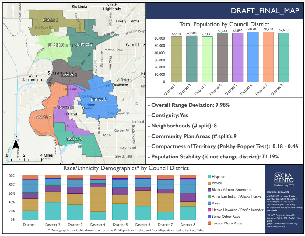
The Sacramento Independent Redistricting Commission (SIRC) has been engaged in a public process for approximately one year to redistrict the City of Sacramento. The SIRC invited the public to submit maps for consideration in the development of new district boundaries. On December 8, 2021, the SIRC completed the final revision of the redistricting map. The Public is encouraged to participate in meetings and provide comments and input on the draft final map.
The SIRC is expected to adopt the final map on Dec 16, 2021. Visit their webpage to view more details and comment.
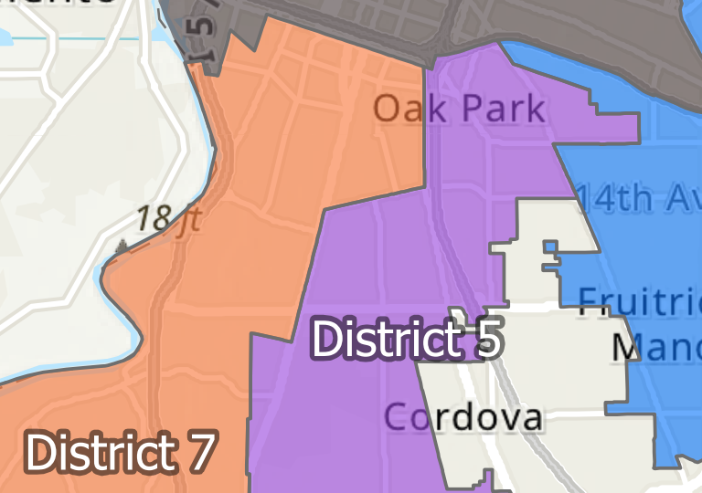
Most significantly, this latest map splits the Sierra Curtis Neighborhood Association boundaries into two different city council districts, placing homes east of Franklin Blvd in District 5 and the rest of Curtis Park in District 7.
Draft Final Redistricting Map