Cases of COVID-19 infection in the area that includes most of Curtis Park have been relatively low compared to adjacent areas as well as compared to city and county totals, according to the latest available data.
The most striking contrasts are in the case rate per 1,000 population – total and for the last 30 days. As of Jan. 25, the 95818 ZIP code had logged a rate of 6.38 cases per 1,000 population in the previous 30 days, roughly one-fifth the rate of downtown (ZIP codes 95811 and 95814), less than half the rate in the ZIP code to the north (95816), and slightly more than half the rates to the south (95822) and east (95817).
The 95818 ZIP code includes most of Curtis Park, Land Park, Newton Booth and Poverty Ridge neighborhoods.
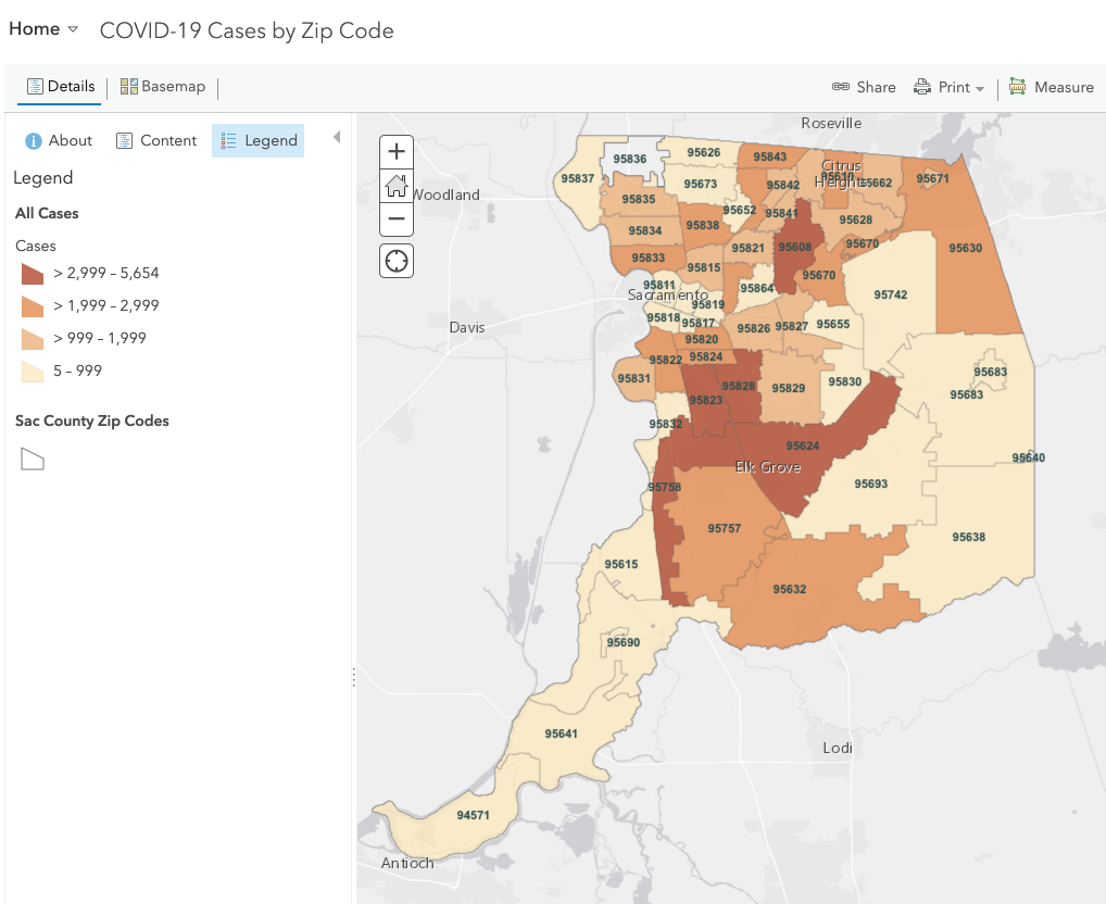
The value of comparing the rate of cases logged in the last 30 days to total cases is that it demonstrates how quickly cases have jumped recently. As of Jan. 25, the Curtis Park area had logged a total of 716 COVID-19 cases. Of the total, about one-fifth of the cases (138) had occurred in the previous 30 days.
COVID-19 is the name of the disease caused by the SARS-CoV-2 virus. The highly infectious virus has rampaged throughout the United States since approximately mid-January 2020, researchers believe.
California’s stay-at-home order took hold approximately March 15, 2020.
Cases of COVID-19 in adjacent areas
| Area | Zip code | Pop. | Cases last 30 days | Total cases | Rate/ 1,000 last 30 days | Total rate/ 1,000 population |
| East Sac | 95819 | 19,890 | 120 | 600 | 6.03 | 29.51 |
| Curtis Park & Land Park | 95818 | 21,625 | 138 | 716 | 6.38 | 32.23 |
| Downtown | 95811 & 95814 | 18,202 | 562 | 1,343 | 30.88 | 71.42 |
| South of Curtis Park | 95822 | 44,741 | 491 | 2,500 | 10.97 | 54.20 |
| Midtown/East Sac | 95816 | 17,199 | 252 | 927 | 14.65 | 51.34 |
| North Oak Park | 95817 | 13,758 | 168 | 759 | 12.21 | 54.08 |
| South Oak Park | 95820 | 36,437 | 542 | 2,143 | 14.87 | 56.21 |
The virus predominantly affects the respiratory system, which means individuals with pre-existing conditions involving the respiratory system – asthma, cardiovascular disease, damaged lungs from smoking and air pollution – are going to be at greatest risk once infected.
There is a well-documented link between lower socioeconomic status and greater illness and higher death rates. It has also been widely reported that communities of color have been much harder hit by the virus.
It is possible that higher COVID-19 rates in poorer ZIP codes can be attributable to those areas having higher numbers of essential workers and lower numbers of people who can work from home, causing greater exposure to the virus.
Because of improved ICU capacity, the Sacramento region was the first to emerge recently from the governor’s stay-at-home order, but the region remains in the purple tier with restrictions on many “non-essential” businesses.
Neighbors are urged to protect themselves and the community by wearing a mask when outdoors, practicing social distancing and washing hands frequently.
Sacramento County offers almost daily updates to its epidemiological dashboards but does not report deaths by ZIP code. Available data may be seen at https://sac-epidemiology.maps.arcgis.com.
SCNA board member Andrea Rosen has a background in public health. Currently, she is working for Berkeley’s Department of Public Health Communicable Disease Division as a case investigator and contact tracer through the California Connected program. Mike Scheible assembled the COVID-19 data.