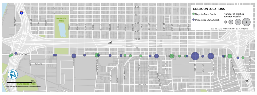
Many Curtis Park pedestrians and cyclists have experienced true fear when approaching Broadway either to cross it by foot or by bike. Broadway often resembles a four-lane highway with cars racing through intersections to make the light or zip through on a yellow.
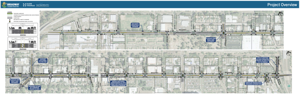
As one of the most significant commercial corridors bordering Curtis Park, the city is preparing some important changes that will improve the user experience on Broadway for all modes of transit – auto, cycle and pedestrians – for the two-mile stretch of Broadway between Third and 29th streets.
Megan E. Johnson, the city’s engineer in charge of this project, reports:
“The roadways nearest the Curtis Park and Land Park neighborhoods – Broadway, X Street, US 50, and W Street – are very auto-centric and cut off the neighborhoods from the central city and even from destinations along Broadway. The Broadway Complete Street project will improve equity in transportation options and make it more comfortable and safer for bicyclists and pedestrians to ride to work, or to the Farmers’ Market or Target, or any of the many nearby day-to-day destinations.”
Last August, the city held a second community outreach workshop in Land Park to provide information about the plans and gather input.
To review a summary of that workshop and study the workshop boards that were presented, use this link.
The policy purpose of putting a road on a “road diet” – through traffic calming and infrastructure improvements – is to increase safety by reducing auto-pedestrian accidents and auto-bicycle accidents, especially at poorly designed auto-centric intersections. Leveling the traveling field for all users is primarily for safety purposes, but it also is aimed at making travel by bike and foot and transit more attractive which reduces pollution and greenhouse gasses. In other words, equity for non-auto travelers.
The project timeline calls for final design and construction drawings to be completed by 2021 and construction in 2022. The contract for the work (estimated at $10 million) should be executed in early 2020. Last month, the city council approved the required CEQA documents. Public reaction to the proposal has been overwhelmingly positive.
Key features
ROADWAY: Reduction from four to two lanes, consistent two-way left turn lanes, on-street parking where appropriate and buffered bike lanes. The project is also intended to connect with major bike connectivity via the Central City Mobility Project, which will extend an existing protected bikeway network on Ninth, 10th, P, Q, 19th and 21st Streets.
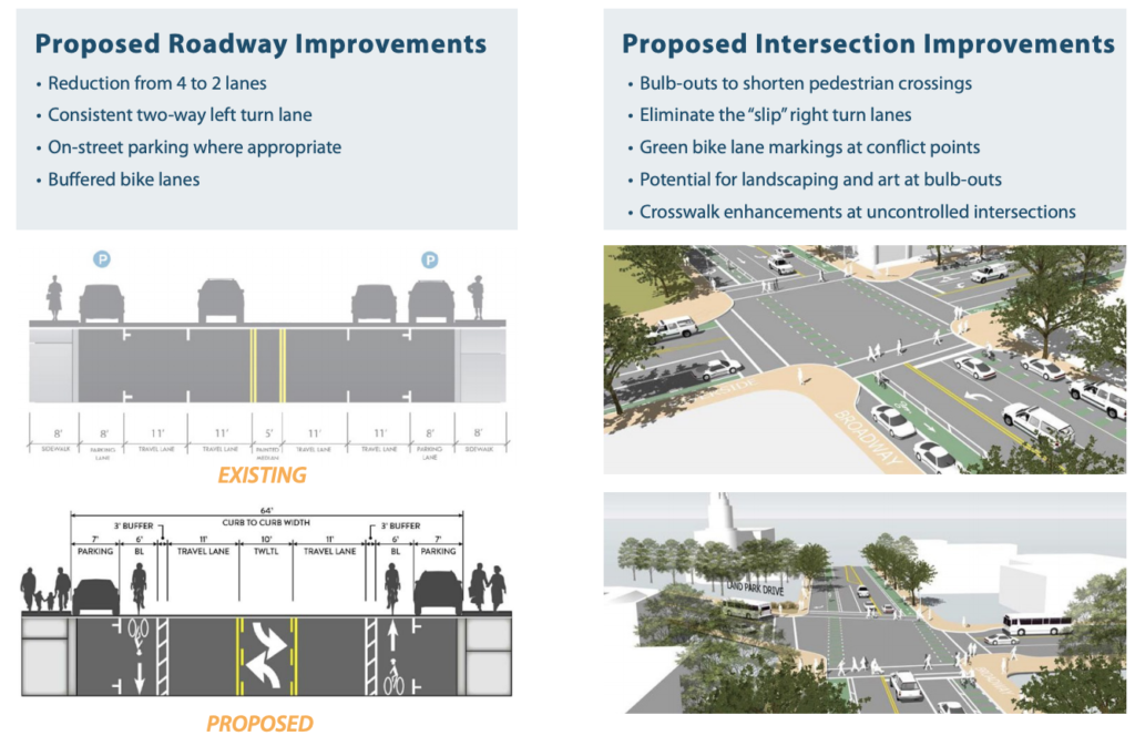
This type of bikeway is a major safety advance for cyclists and motorists and will enhance bike travel onto the grid from Curtis Park across Broadway.
INTERSECTIONS: Bulb-outs to shorten pedestrian crossings, eliminate the “slip” right-turn lanes (dangerous to pedestrians), green bike lane markings at conflict points, potential landscaping and art at bulb-outs and crosswalk enhancements at uncontrolled intersections.
For details, contact Megan Johnson, 916 808-1967 or mejohnson@cityofsacramento.org.